Wednesday 18 December 2013

Further East in Ladakh

A ride from Tangtse to Chushul (near the Indo-China border) and once again some changes in terrain, fauna, people. Very few changes that were observable in the flora (anyways there is hardly any). It is said that earlier there was no vegetation in the eastern part but the DRDO took up the initiative and replicated the vegetation of western ladakh. This is evident if one compares the Aksai Chin to Eastern Ladakh which is not visited much due to military reasons. The black necked crane (state bird of J&K) is finally seen here.


black necked crane

crossing a 5000m pass (unnamed). Easy terrain: gradual and wide

Coming up in future posts, is the most fantacized route: Leh-Manali

PangongTso II some more angles


brown and black headed gulls are present during summers

A full moon over a lake is a delight!

Friday 1 November 2013

PangongTso

Some of the best landscapes we saw
Crossing Changla took me quite long as expected. Crossing high passes keeps getting tougher with every metre of climb. The downhill there after was initially tough due to the snow-ice forming on the road. But crossing Changla after 3 has its advantages. There are no vehicles moving in my direction and the ones opposing also reduce in numbers leaving a great downhill to enjoy with thrill or just sit on the saddle and feel the serene valley. I was involved in both and many times looking down below at the valley did resemble like flying in a chopper but that thrill I tried to avoid on downhills least the reality and the dream coincide!
After a night halt at Tangtse, I moved off early to the nearby lake of Pangong. Any body coming from Leh will take their time to cross Changla and anybody at Pangong would not be willing to leave the place in the morning. My prediction was right again and I got the deserted road with occasional visitors like spectacular birds, wild asses, Yaks, goats and the BRO. The rides in these regions were one of the best I ever had.
The Pangong has a rich dark blue colour while under the sun. The colours vary quite a lot with time and it is fun to watch the variations especially from an elevation. Climbing on to hills, I was fortunate to have the perfect view (well one of many).
One of the perfect Pangong view
Bird watchers would be delighted at the number of Siberian visitors and other locals.


Tuesday 15 October 2013

Eastern Ladakh II : ChangLa

ChangLa was the second big pass (5000m+) that challenged me. It was a slightly longer uphill than the one at Khardung La. I started from a slightly higher altitude (Karu base) as compared to Leh market and the slopes were also more challenging on this route. Aware of the old controversies over the altitude of KhardungLa, I had measured them with my GPS. So did I repeat the procedure at ChangLa, resulting in ChangLa being the heighest Indian motorable road and fortunately with lesser traffic(due to lack of the title KhardungLa possesses) and better roads(so far all comparisions made with KhardungLa). I was expected to be acclimatised and so was I but honestly, the head still ached terribly. The slightly uncomfortable bumps seemed dangerous. It wasn't as bad as KhardungLa where I had to stop a lot more just to stay safe but here too I wanted to cross over early. No matter how fast I coevered the initial 75% of the mammoth uphill, the latter 25% (last 12kms) took more time than the earlier. And if one digs into details, it so happens that last 3 kms took over an hour! It kept getting tough as the roads further got bumpy. It is on these kinds of upslopes that the rear tyre skids and instinctly I tried to pedal harder.
Reaching the top felt like an achievement. The army offers free tea to all the tourists and takes good care. I was the special guest at that moment being welcomed, cheered, encouraged and well fed :)
The high passes usually have a tough downhill around 10kms on either sides(an exeption of TanglangLa- see future posts). This was no exception. The melting ice had made the road into pebbled rivers and the freezing fingers had to be kept alive.There after it was a neat speed and scenic ride till Tangtse. The sense of complete freedom was relished the most in eastern Ladakh though a man is never completely free. I had the borders and military restrictions at many places for my own good. The place had more of endangered species of animals than the least concern homo sapiens.
The heighest road under my consideration: Great Job BRO

Yaks feasting on whatever little icy grass they can manage

Saturday 28 September 2013

Eastern Ladakh I

Leh has a lot of cultural display regarding Ladakh, but due to commercialization, it is bound to change. The prosperity has led to modern buildings. To have a look at 'not so modern' Ladakh, one has to move away to Karu or Upshi or even further to Rumtse. Eastern Ladakh starts showing of variations in terrain as well with more vast open spaces and a higher elevation. After crossing over Khardungla on my return, I ended up in Karu and perched around near by villages. This was the longest stay as I had to wait for the fantastic Leh Manali route to open up. Meanwhile, I explored Pangong Tso and Chushul regions. Eastern Ladakh stays the best part of the journey with lots of scenic moments and good tough experiences. The heighest passes were fought in this region. 7 out of 10 times I crossed 5000m altitude mark on the bike. While some say it was the man not the machine to achieve such feats, I would have to agree. If it weren't for Mr. Cannondale, 12000cc of thighs would not have scaled the heights so efficiently and quickly!
Solar Cooker. 2 houses: an old and a new one
On the way to Pangong Tso

Chemrey Gompa cluster on the hill

Tsoltak: snowed on ChangLa

529mbar of pressure on Changla! almost half of that at sealevel! Killer...


Wildlife near Khardungla

On my return, as I struggled up to North Pulu, the ride had lots of surprises in the form of wildlife. That was the most active day in the complete regarding wildlife. But one has to ensure that the animals are not scared away by the motor sounds and what I missed while I hurried down the slope was mainly due to speed and sunset. Some of them find their way to this blog while animals like ibex are too common to find on the ridges high up during mornings and evenings.


Monday 8 July 2013

Wind on mountains

Some times wind on mountains provide for a much fascinating view. After some show, I decided to take this video

Nubra and Shyok Valleys


 The Nubra and Shyok Valleys are almost adjacent and split a little distance from Khalsar. Though both together are also called Nubra valley usually. Nubra means flowers. There are a lot of wild flowers which had not bloomed while I was there but did manage to see some of them. There are just too many oasis in this desert and riding along the river is a treat for the eyeballs. Going along the Shyok river, one comes across the sand dunes at Hunder and farm lands there after for quite some time.  The double hump camel is the landmark in this region. While crossing the sand dunes, I was actually caught up in the dust storm but it was a thrilling experience. The prologue of the dust storm was what I could record.
After the storm: A relief

The frequent landslides and other harsh factors contribute to erosion but one can even see the formation of sedimentary rocks. Playing with them, one can realize the diverse toughness of these rocks which could be attributed to their age or method of formation.
The dogs in this region are known to have killed Humans at times. Some of them managed to chase me from under the bridge while I was riding over it and did not give up even after we were on different sides of the river. Reaching the last Indian village of Tyakshi and then returning on the same route also seemed interesting. Got a lot of time to hang around with the lazy camels. Most of them are domesticated by the villagers of Hunder and the only work they have is to showcase themselves. (tourism icons)
At this point of time most of them were shedding their fur as summer approached


Tuesday 25 June 2013

Life on the other side of Khardung La

2 hours later it will grow dark and I am still an unknown distance away from Khalsar. So far no milestone has given me this information. An upper bound of 50kms should be a safe consideration. A further downhill should give a good speed but the roads do not support it and are way to narrow and curvacious.
This was the situation at North Pullu and despite lights, I did not want a ride in the dark night. I accelerated spontaneously and tried to maintain speed above 30 on those rugged downhill with almost no weight on the saddle. Bike control was an enhanced skill and my bike had achieved a top speed of 75 kmph just a few days back. There was hardly any one coming from the opposite direction as no one attempts to reach Khardung La in the evening and also hardly anyone left in the direction. The road was laid out just for me :)
There was no hesitation to stop and take pics. The terrain was way too interesting. Also the place has varied wildlife due to the altitude variation (A drop of over 2000m) which I was unable to spot on the speedy downhill late evening ride but later observed pretty well on the return way up. There was just one village, Khardung, on the way till Khalsar. 
Characteristic erosion patterns

Meandering River at Khalsar

Sunday 16 June 2013

The Route approx.

A look at the bigger picture after lots of focus on J&K. The map shows only the major locations.

End of a long ride

The velometer reaching 5 digits made it a long ride. The ride is over but there is a lot to be shared. I spent over 6 weeks in J&K and away from internet and telephone at times, which I hardly ever missed. The blog shall remain active in coming future and postings might be a bit regular again.
Entering J&K from Udhampur side, saw me drenching in the rain almost everyday till Zojila. So far there had been some tough rides but Zojila was a different level. It wasn't tiring but the weather made the going difficult. It was a heavy snow fall and I had to stop short of what I had planned; a rare event as of then. The next morning I headed towards Kargil but one slip and there was a scare of any wet road.

 Later on the road till Leh the passes steadily rose ensuring a better acclimatization. On the way I was fortunate to have luxuries of a kerosene heater at times which usually makes one suffocate after a while. Riding becomes difficult after such times.

Srinagar-Leh route has fascinating and varying landscape. One of such extremes is at Lamayuru which is called the moonland. The pictures tell the remaining story (at the end)

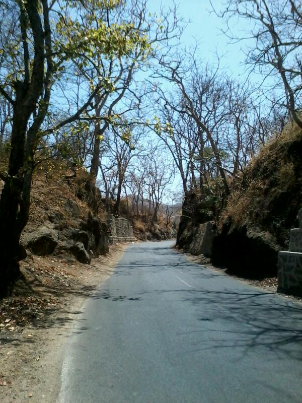
Road after Khardung La
In order to get to Nubra and Shyok valleys, there was the first huge obstacle: Khardung la and though there were suggestions to cross it in the first attempt, I took a day off for a rehersal/acclimatization/check ride. There was a headache on the following day as well and Iwas slow enough to take around 3 hours for the last 12 kms of the climb. It usually is a great relief to reach the top after working your heart out. But stories change over 5000m. Descending was time consuming as well. Reason evident from the pic above. The ride till Khalsar showed a terrain which made the experience far more thrilling than that of Lamayuru. (coming up in later posts)
Moonland, Lamayuru


Friday 3 May 2013

Ladakh

A post after a long time. It has been NH1 since a long time and continuing still. Kashmir was a green delight but the pics I am posting are mostly from Ladakh :)
Struggling my way through zojila's snow storms and thereafter slipping on some occasions on the slippery icy roads, I reached heaven.

But to reach such a wonder, there was a lot of suffering which later was compensated :)
With my half cut gloves, I had to improvize to protect my fingers in the biting cold. The extra socks helped and polythene over them also made them waterproof and windproof but the very first slip had the polythene gone. Determined to cross the avalanche prone area before the Sun got furious, I decided to walk-jog down the stretch. But it was still slippery. The army had stopped the remaining traffic to Drass that day and I was probably the only person to reach Drass :D
Recently opened Zojila: I still had the patience to take the pic

Sunday 21 April 2013

Summer Migration

Cannondale and I have now successfully migrated to colder land though not avoiding the heat but going through it.
Riding from Amritsar to north Punjab in the cold rain and Himalayan headwind ensured it was a steady transition. Had I taken the eastern wing, I would have been in the snow with my blood pasteurised. But currently the snowline has only come in sight and might be a week before I put my footprints on it. In the pic, the snowline from today's home.

Thursday 18 April 2013

NH1 ride

Heading towards Amritsar on the GT Road. Punjab has lots of wheat farms and with the harvest season going on, I got to eat farm fresh wheat. Switching back to western wing for migrating up north but before that I shall be halting near Atari. Blog to go on sleep mode  next week.

Tuesday 16 April 2013

Entry to Punjab

Rajasthan-Haryana-Punjab for today. It was a farm ride. Wheat farms till the horizon and finally finding shade was easy.
As I moved north, I dealt with cross winds which soon will be headwinds from pak. A bit of a dodge here as to which wing to take: east or west. For now, it is time to rest.
present location: Bhatinda

Sunday 14 April 2013

End of deserts

Main course begins... Though the region still seems arid, nearing north is a bit relieving. Carrying too much water makes me feel like a tanker instead of a tank. Reaching bikaner, witnessed a local mela(fare). A glimpse in the pic.
About the ride...another quick one and though not a wildlife sanctuary, the wilderness was well showcased. I was shown an eagle eating his juicy meal and 3 deers hopping across the road. The lizards are almost always active here. Failed to capture those quick creatures.
So where do I go tomorrow?

Friday 12 April 2013

Golden town Jaisalmer

Too much of rocks and sand to ride on makes me feel I am riding a tank. It was a great decision of not changing to sleeks but going with the 2.1 inch tyres.
Wandered around the desert national park but during the day when only camels and exceptional humans are out. Beneath the shrubs, rodents and birds can be found. Snakes don't dare to wander around in the heat. Will explore this place again in future with a tent.
Riding among the camels in a dried up lake was a great experience. Made me feel like their drill instructor. I am not sure about the 'dried up' part but one must not consider innocent water to be mirage based on past desert experiences.

Wednesday 10 April 2013

Desert life

Reactions to water and food shortages: packed food and 5.2l of water; sometimes gets tough to carry them but nevermind. I have transitioned from salt to sand desert in the past week. Tomorrow I would be at Jaisalmer.
In the pics, a salt crystal from the kutch.

Sunday 7 April 2013

Welcomed by a mountain

Every state I enter, there are hills around(attract/distract ;-)). Mount abu is one of the hottest big hills to climb in India(probably the one). But well baked and heat treated, I was in good condition to enjoy the road and the view. A quick and early start from Deesa ensured I had lots of time to roam around in Abu. The  day started with a jeera flavoured road. Loads of trucks moving around with that strong smell.
The rocks at Mt Abu are way too attractive. It is a climbers' paradise but currently the climber in me is on hiatus.
The pics from the climb.

Thursday 4 April 2013

Kutch ki safedi

Riding 180kms through the hottest part of the country and that too with winds...feels cool(after the ride ;-) )
Crossed the tropic of cancer, not for the first time though but saw a board. Reaching the vast white desert with just white floor beneath extending till the horizon is a great experience but does not make a great pic. So in the pic is a friend from the other species.

Kutch

Getting solar charged in kutch :-) Tomorrow I leave to patrol the border area again but tonight relaxing at Bhuj. For numerophiles, the news is of completing 5k kms.
In the pics: a popular hangout for deers and a small lake (puddle) and thats not snow :-)

Tuesday 2 April 2013

The last man on Indian land

*The last civilian
To watch the sun set. Another extreme of the country but this time the climate is extreme too. Riding through hot conditions and overloaded, I decided to carry 2.2l of water for a short journey which was a wrong decision. Detours made the ride longer, headwinds tougher and no villages made me thirstier.
The first no-ceiling night came pretty late in this tour, but was enjoying the cool evening in the gurdwara. Decided to sleep stargazing but soon 'cool' became 'cold'.
Plenty of wildlife to lookout for. Made friends with some.
Morning exploration was near the border. Once a port, but after Indus changed its course, the rann has lots of corals to hunt for but beware of quicksand at places.

Friday 29 March 2013

Kutch nahi dekha to kya dekha!

2 days of air resistance...to the limit that I had to use the granny. Unfortunately the roads are too good in Gujarat and even the heavily loaded trucks are unfit to pull.
The net connectivity is unstable so blog updates will remain short and irregular.
The terrain is pretty colourful and the heat is good to bake. This is just the entry into kutch. Lots to explore and will cover it well.

Wednesday 20 March 2013

Khoobsurat Surat

The western edge of Surat is an interesting chunk of land. Mangrove forests on the map looked fascinating so I set out towards the coast. The islands just had thorny shrubs and could not find a 'convenient' way to reach there so decided to greet them from a distance. I was inside some industrial estate which I managed to trespass. While trespassing, I came across a board that welcomed me to the Das Island. Wonder how and when I crossed... the terrain has changed a bit may be due to industrial activities and it was a low tide at that time. Continued to move south waiting to move till the end and checked my position on the GPS after some time... to find myself deep inside the Arabian Sea. Not for the first time the maps showed me in the water body but for the first time I was way inside the sea ;)
So far no problems relying on these maps.
After a long time I got to see the sandy beach; the Suvali beach.
Some guys from nature club had brought a snake, a lazy one and was fortunate to get a chance to play around with the red sand boa. The beach had sea gulls,  cranes and some other interesting birds as well but I had this chubby snake in my hands.

The Dumas beach is yet another cool beach to visit but way to clayey to wander around.

Lots of sand riding today... truly coastal